
Trace a Fort Bend County Street
Fort Bend County has no public household roll arranged by street. A sound street-by-street search instead moves from an address to the appraisal account, map point, legal description, recorded documents, permit source, and then older directories where a useful year exists. The sequence separates a recorded owner from an occupant, and it preserves the source that supplied each fact. Start with the address as printed, including any directional and suffix. Normalize variants only for searching, not for rewriting the original record.
- Search the street number and street name in FBCAD eSearch. Save the owner display, situs, Quick Ref or Geographic ID, tax year, and any legal-description lead.
- Locate the same place in the county GIS environment. Compare the street point and parcel geometry, including aliases, postal city, ZIP, and city, ETJ, or unincorporated context.
- Use the owner name and legal description in the County Clerk's party-centered index. Follow the latest deed to the prior grantor, retaining the instrument number and recording date.
- Determine which government has permit authority. Incorporated-city addresses use that city's process; unincorporated development work follows the county Engineering route.
- Use the Elections Street Guide and precinct maps for civic geography, not as a public resident list. The voter inquiry is an individual lookup.
- For a past address clue, consult a reverse or criss-cross directory only for a year the collection actually holds, and record the volume and entry.
Each link in the chain has a different purpose. The result is stronger when the address, parcel identifier, owner name, legal description, and dates agree rather than when one search result is treated as conclusive.
Fort Bend County Street Directory Fields
Fort Bend Central Appraisal District eSearch is the best first stop for a current address lead. Its visible search tabs include Search, ARB Search, and Advanced Search. The basic approach accepts address, owner, or ID searches; the advanced form makes a whole-street query more practical through separate Street Number and Street Name fields. If an exact address fails, FBCAD advises simplifying the street name. Treat a matching account as an appraisal record, not a finding about every person at the address.
| FBCAD field | How it helps by street | Keep with the result |
|---|---|---|
| Owner Name | Tests a listed owner or business name after an address result. | Exact display and name variants searched. |
| Street Number and Street Name | Finds an address or narrows a street segment. | Normalized query and original address. |
| Quick Ref ID, Geographic ID, Owner ID | Supplies parcel or account leads for later cross-checks. | The identifier label and value. |
| Subdivision, Condo, Neighborhood, Abstract | Connects a street address to a development or survey grouping. | Selected list value and tax year. |
| Property Type and Tax Year | Places the appraisal result in the right account and assessment period. | Displayed classification and date context. |
The visible roll is identified as the 2026 certified roll, and values can change. FBCAD also cautions that legal description and acreage information should be verified before legal use. A current street directory result should therefore lead to the parcel map and recorded instrument, rather than be treated as the complete property history.
Fort Bend County Street Address Points
Fort Bend County's public address-point service shows the address data used to place a search on the map. It can distinguish a street number, name, suffix, alias, city, postal city, ZIP, county, state, and address class. The service has an ADD_UNIT field, but the county notes that unit information is not part of the basic public address display. Map evidence provides location context, while title and assessment questions remain with the Clerk and FBCAD.
The public address-point layer is the county source behind this Fort Bend County street directory image.
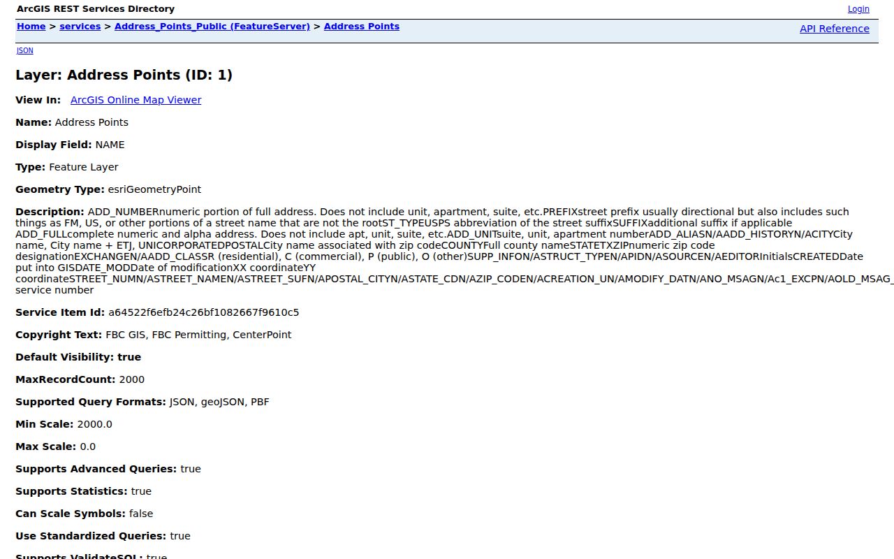
Use the point to test spelling, directional, suffix, and postal-city variations before moving back to the appraisal account. A mapped point is not proof of ownership or occupancy.
The broader GIS catalog includes parcels, boundaries, FEMA, schools, parks, roads, public safety, transit, and water-district layers. Those overlays help distinguish an address within a subdivision from the surrounding public geography. They do not replace the legal description that appears in a recorded instrument.
Fort Bend County Address Labels
Three address labels can describe the same property without meaning the same thing. A situs is the physical taxable location used for the appraisal account. A mailing address is the correspondence address used for tax-roll mail. The GIS point adds geographic and postal context, which may include a postal city or ZIP that differs from a municipal boundary. Keep each label exactly as the issuing source displays it.
- Parcel
- A mapped tract or account area used to identify property; its shape is not a title decision.
- Situs address
- The physical taxable property location shown in an appraisal record.
- Plat
- A recorded map that can connect a subdivision, lot, and block to a street location.
- Criss-cross directory
- A historical directory arranged by address, sometimes with an occupant or telephone clue for that printed year.
A nonmatching mailing address may show where an owner receives correspondence, but it does not identify a current occupant. Likewise, a postal-city label is not a city-limit ruling. Compare the raw address, the FBCAD situs, the GIS city or ETJ field, and the legal description before deciding two records concern the same place.
Fort Bend County Street Records
The same street can occur in more than one record system, but the key changes as the search progresses. A Fort Bend County street directory search separates what is address-keyed from what is only a supporting clue. It also shows why a matched owner, point, or document should be checked against the others before it is relied on.
| Address-keyed source | What it can establish | Access channel |
|---|---|---|
| FBCAD appraisal account | Current owner display, situs, mailing address, account identifiers, tax year, and property filters. | Public eSearch; use Street Number and Street Name. |
| County GIS layers | Address points, parcel geometry, boundaries, city or ETJ, postal-city, ZIP, and public overlays. | Public map and ArcGIS services; verification request route also exists. |
| County Clerk recorded index | Party roles, filing dates, instrument numbers, document types, and deed-chain leads. | Public interface; copy or image access follows the portal and Clerk process. |
| Permit authority | Publicly available development or code material tied to work at an address. | City system for incorporated areas or County Engineering for unincorporated work. |
| Historical criss-cross directory | A past address-to-occupant or telephone clue for the volume's year. | Library collection where a relevant volume exists. |
Fort Bend County's published InteractiveMap services show the public layer categories available around a street.
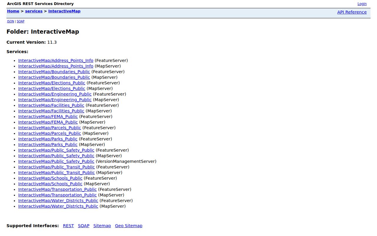
Use the map as the connector between an address and nearby public layers, then rely on FBCAD for assessment information and the Clerk for recorded title material.
Fort Bend County Street Deed Chain
The County Clerk's Official Public Records interface is party-centered, not described as a direct street-address search. The county describes its online public-record library as reaching from 1821 to the present, subject to the portal's index and image workflow. Start with the FBCAD owner, legal description, subdivision, lot and block, or abstract. Then search party name, grantor, grantee, date filed, instrument number, and document type in Aumentum.
A grantor transfers or conveys an interest; a grantee receives it. Follow the current listed owner as grantee on a deed, capture the seller or prior grantor, and repeat backward while checking the legal description. Deeds, plats, mortgages, easements, liens, releases, and powers of attorney can all appear in the index, but only some establish a change of ownership. The portal requires JavaScript and session cookies, so an unavailable image or session should be noted rather than guessed.
Note: Preserve the instrument number, party roles, document type, and recording date so a later search can be reproduced without assuming the address itself was a Clerk search key.
Permits on Fort Bend County Streets
Permit and code material can be keyed to an address, but its keeper depends on jurisdiction. Incorporated cities manage their own building or planning systems. County Engineering handles unincorporated development permitting through its published route and MyGovernmentOnline. A record should retain the permit or case number, work type, issue or inspection date, status, applicant or owner field if public, and any plat or plan reference. The reviewed research did not capture a live city permit or code-case result.
Fort Bend County Engineering's development-permit information documents the unincorporated route shown in this Fort Bend County street directory image.
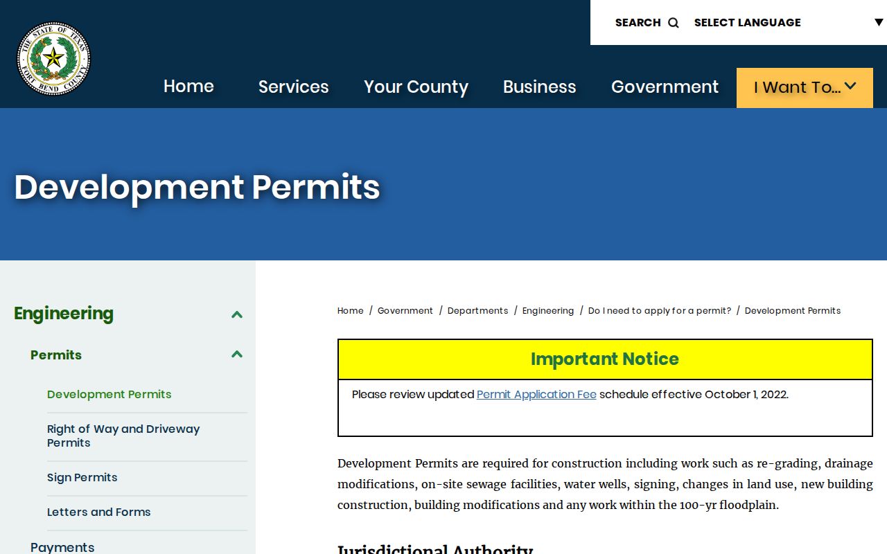
The county route should not be assumed to cover an address inside Richmond, Rosenberg, Sugar Land, Missouri City, Stafford, Fulshear, or another incorporated jurisdiction. Confirm the government shown by the GIS address context before requesting a permit record.
Historic Fort Bend County Street Clues
Historic streets can be harder to reconcile than a current parcel search suggests. Older deed, marriage, and probate books may use a lot, block, abstract, survey, community, or post-office name instead of a modern street address. A plat can bridge a subdivision label to a street, but it does not by itself prove current ownership. Preserve the original wording before matching it to a GIS point or current account.
Printed reverse directories are irregular, so a historic street directory clue belongs to the date and volume where it appears. George Memorial Library, the Historical Commission, and statewide directory holdings are useful follow-up channels when an older street label appears. For the directory collections and their holding questions, use the Fort Bend County city directory collections rather than assuming a continuous run exists.
Fort Bend County's early record history also means the online library's broad date description should not be read as proof that every original image is available. Where online coverage is uncertain, TSLAC microfilm paths and the library's reader-printer are documented alternatives.
Fort Bend County Street Precincts
Fort Bend Elections maps provide a Voter Street Guide and precinct maps that can add district context to an address. They are especially useful when a street range, ZIP, and precinct need to be compared. Precinct boundaries can change, so record the election year or map date that supports a result.
The county voter inquiry is an individual lookup with VUID, date-of-birth, first-name, and last-name controls. It is not a public street roll and does not prove a person's current physical presence or voting choices. Texas rules also protect selected fields and allow web suppression in some circumstances. Use the guide for geography and the individual inquiry only for a legitimate, specific record question.
Limits of Fort Bend County Street Directory
Address records can identify parcel geography, a listed owner, recorded parties, or an older printed clue. They do not provide a complete list of renters, all household members, utility customers, delivery recipients, or unlisted people on a street. Nearby records can also be stale, use a mailing address, or describe a property connection rather than a present-day resident. Protected voter fields, address-confidentiality programs, and motor-vehicle privacy limits are important boundaries.
Lawful use. Fort Bend County street records support personal research, family-history work, and property curiosity. Do not use an address, map point, or recorded name to stalk, harass, intimidate, or harm anyone.
For a correction or privacy concern, contact the office that holds the original record. A correction, confidentiality, or suppression procedure is source-specific, and removing a private listing does not alter a county source record.